H2: What a Hurricane Is
A hurricane is a powerful, rotating tropical storm with sustained winds that reach hurricane strength, organized around a calm center called the eye. Hurricanes are known by different names in different parts of the world: they are called typhoons in the northwest Pacific and cyclones in the Indian Ocean and South Pacific, but they are the same kind of storm. What defines a hurricane is its structure: a spiral of thunderstorms rotating around a low-pressure center, fed by warm, moist air rising from the ocean. Hurricanes can span hundreds of miles, last for days or weeks, and bring dangerous winds, heavy rainfall, storm surge, and flooding far inland. Understanding how they form helps explain why they occur in certain seasons and regions, and why some storms strengthen rapidly while others fade.
H2: The Ingredients: Warm Water, Moist Air, and Calm Winds
Hurricanes need several ingredients to form, and if any one is missing, a storm may fail to develop. First, ocean water must be warm, generally at least around 26 degrees Celsius, to a sufficient depth, because warm water provides heat and moisture that fuel the storm. Second, the atmosphere must be moist, especially in the middle levels, so that rising air does not dry out and weaken thunderstorms. Third, winds at different heights must not differ too much, a condition called low wind shear, because strong shear can tear a developing storm apart before it organizes. Fourth, there must be a pre-existing disturbance, such as a cluster of thunderstorms or a tropical wave moving off Africa, to give the storm a starting spin. Finally, the storm must form far enough from the equator for Earth’s rotation to give it spin, since the Coriolis effect, which deflects moving air, is too weak near the equator to organize rotation.
H2: From Disturbance to Organized Storm
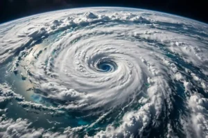
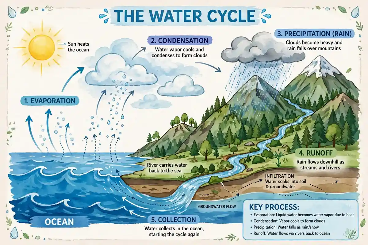
Hurricane formation begins when warm, moist air over the ocean rises, cools, and condenses into clouds and thunderstorms, releasing latent heat that warms the air further and causes it to rise even more. That rising air creates low pressure at the surface, which draws in more warm, moist air from surrounding areas, feeding a cycle that can intensify if conditions remain favorable. As air spirals inward toward the low-pressure center, Earth’s rotation deflects it, creating the storm’s characteristic rotation: counterclockwise in the Northern Hemisphere and clockwise in the Southern Hemisphere. Gradually, thunderstorms organize into curved bands around a center, and if the cycle continues, a calm, clear eye may form at the center, surrounded by the eyewall, a ring of the storm’s most intense thunderstorms and strongest winds. That organized structure marks the transition from a disorganized disturbance to a true tropical cyclone.
H2: The Eye, Eyewall, and Spiral Bands
The eye is the calm center of a hurricane, typically tens of miles across, where air sinks gently and skies may clear, even while violent weather rages nearby. Surrounding the eye is the eyewall, where air rises most vigorously, producing the heaviest rain and strongest winds. Beyond the eyewall lie spiral rainbands, curved bands of thunderstorms that spiral outward, bringing rain and gusty winds to areas far from the center. The storm’s winds are strongest in the eyewall and weaken outward, while its rainfall can extend hundreds of miles from the center. Storm surge, the rise in sea level caused by the storm’s winds pushing water ashore and by low pressure, is often the most dangerous hazard, especially when it coincides with high tide. Understanding this structure helps explain why the calm of the eye can be misleading: the worst weather returns quickly once the eye passes.
H2: Why Some Storms Strengthen and Others Weaken
Whether a hurricane strengthens or weakens depends on the environment it moves through. Warm ocean water, moist air, and low wind shear favor strengthening, sometimes rapidly, while cool water, dry air, strong shear, or landfall tend to weaken a storm. Landfall cuts off the storm’s supply of warm, moist ocean air and increases friction, causing winds to decrease, though rainfall and flooding can remain dangerous well inland. Some storms undergo eyewall replacement cycles, where a new eyewall forms outside the old one, temporarily weakening the storm before it may strengthen again. Upper-level winds can also ventilate a storm, carrying heat away and allowing it to intensify. Forecasters monitor all these factors with satellites, aircraft, and computer models, as described in the satellite work in how satellites work and the research in research in everyday life and scientific inquiry.
Hurricanes, Climate, and Warmer Oceans
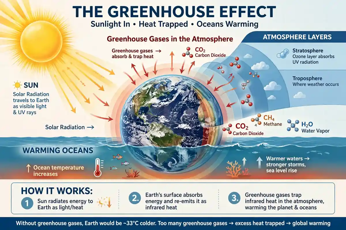
Climate change does not create hurricanes, which have occurred naturally for millennia, but warmer oceans and a warmer atmosphere can influence their behavior. Warmer water provides more energy for storms that do form, and warmer air holds more moisture, which can lead to heavier rainfall. Sea-level rise increases storm surge flooding, because surge starts from a higher baseline. Scientists are still studying how climate change affects hurricane frequency, and the evidence is less clear there than for rainfall and surge, but the direction for intensity and rainfall is a growing concern. Protecting coastal ecosystems, such as wetlands and mangroves that buffer storm surge, as discussed in protecting ecosystems, is one way communities can reduce risk even as storms change. Understanding these links helps separate natural variability from long-term trends.
H2: Forecasting, Warnings, and Preparation
Modern hurricane forecasting has improved dramatically, thanks to satellites that track storms from space, aircraft that fly into storms to measure winds and pressure, and computer models that simulate possible paths. Forecasters issue watches and warnings to give communities time to prepare, evacuate if ordered, and protect property. A watch means conditions are possible within a certain time, while a warning means they are expected, and the distinction matters for planning. Preparation includes knowing evacuation routes, having an emergency kit with water, food, medicines, and important documents, securing outdoor objects, and staying informed through official sources. After a storm, hazards remain, including flooding, downed power lines, and contaminated water, so returning home should wait until officials say it is safe. The same careful observation that guides space missions in how rockets work and Artemis program also guides storm forecasting: measure, model, and update as new data arrive.
H2: Hurricanes in the Wider Earth System
Hurricanes are part of Earth’s system for moving heat from the tropics toward the poles, redistributing energy that builds up where sunlight is strongest. They also bring rainfall to regions that depend on it, even as they cause destruction. Their formation connects ocean temperatures, atmospheric moisture, and planetary rotation, linking the smallest cloud droplet to global circulation patterns. The Sun’s energy, harnessed by how solar panels work, drives the evaporation that feeds hurricanes, while the Moon’s gravity, which drives tides, can worsen surge flooding when storms arrive at high tide. From the invisible forces in what dark matter is and what black holes are to the living systems in what DNA is, what stem cells are, and world of microbiology, Earth is a connected system, and hurricanes are one of its most powerful expressions. Respecting that power, through science, forecasting, and preparation, is how coastal communities live more safely with these formidable storms.
H2: Living With Hurricane Risk
For people in hurricane-prone regions, living with risk means planning year-round, not just when a storm appears on the forecast. That planning includes understanding local flood risk, which may differ from wind risk, knowing whether your home is in an evacuation zone, and reviewing insurance and emergency plans before hurricane season begins. It also means helping neighbors, especially older adults and those with limited mobility, who may need assistance evacuating or preparing. Communities that invest in stronger building codes, restored wetlands, and clear communication tend to recover faster after a storm. Hurricanes will continue to form as long as warm oceans and moist air exist, but with knowledge, preparation, and respect for official warnings, their human cost can be greatly reduced.
After a Hurricane: Recovery and Resilience
Recovery after a hurricane is often longer and harder than the storm itself, involving power restoration, debris removal, housing repair, and support for people who lost homes, jobs, or loved ones. Floodwaters can linger for days, mold can grow in water-damaged homes, and infrastructure such as roads, hospitals, and water systems may need extensive repair. Communities that recover fastest tend to have strong social networks, clear leadership, and plans made before the storm, including mutual aid agreements and pre-positioned supplies. Individual recovery also matters: documenting damage for insurance, avoiding scams by unlicensed contractors, and seeking help for stress and trauma are all important steps. Recovery is not just about rebuilding structures; it is about rebuilding lives, livelihoods, and a sense of safety, and it requires patience, resources, and community support long after media attention fades.
Resilience means building back in ways that reduce future risk, not simply restoring what was there before. That can mean elevating homes in flood-prone areas, strengthening roofs and windows against wind, restoring wetlands that absorb storm surge, and improving drainage in cities. It can also mean updating building codes, investing in backup power for critical facilities, and ensuring that warnings reach everyone, including people who speak different languages or lack reliable internet access. Each improvement, however small, reduces the damage from the next storm. Hurricanes cannot be prevented, but their human cost can be lowered through science, planning, and investment, turning each storm’s lessons into stronger, safer communities for the future.