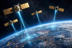
Every time you follow the blue dot on your phone to a restaurant, track a delivery in real time, or watch your car’s navigation reroute around traffic, you are using one of the most ambitious engineering projects in human history. The Global Positioning System — GPS — pinpoints your location anywhere on Earth within a few feet, using nothing but radio signals from satellites 12,550 miles above your head. Here is how it actually works.
How Does GPS Work? The Short Version
Your phone’s GPS receiver listens for radio signals broadcast by a constellation of at least 24 satellites orbiting Earth. Each satellite constantly announces exactly where it is and precisely what time it sent the signal. By comparing how long each signal took to arrive, your receiver calculates its distance from four or more satellites — and where those distances intersect is your location.
The whole process takes less than a second and requires zero input from you. No cell towers, no Wi-Fi, no internet — just faint radio waves from space and some clever math.
The Satellite Constellation Behind GPS
The United States Space Force operates 31 active satellites in six orbital planes around the equator, each tilted 55 degrees. They circle the planet twice daily at roughly 8,700 miles per hour, so at least four satellites are always overhead from any spot on Earth — usually eight or nine.
Every satellite carries multiple atomic clocks — the most precise timekeeping devices ever built, accurate to within billionths of a second. This precision matters enormously, because the entire system is really a giant stopwatch: it measures the travel time of radio signals moving at the speed of light, about 186,000 miles per second. A timing error of one microsecond would throw your position off by nearly 1,000 feet. GPS is far from the only satellite network overhead — for one that delivers internet instead of navigation, see how Starlink works.
Trilateration: The Math That Finds You
GPS location is calculated through a technique called trilateration. Imagine you know you are exactly 50 miles from one landmark, 40 miles from a second, and 30 miles from a third. There is only one point on the map where all three circles intersect — and that is where you are standing.
GPS does this in three dimensions:
- One satellite tells your receiver it is somewhere on the surface of a giant sphere.
- Two satellites narrow it to the circle where two spheres intersect.
- Three satellites shrink it to two possible points — one is usually in deep space, so the other is you.
- A fourth satellite confirms the result and corrects the timing errors in your phone’s cheap quartz clock.
That fourth measurement is the secret. Your phone does not have an atomic clock, so the receiver solves for time as a fourth variable. The correction it computes fixes the phone’s clock to within nanoseconds — which is why your phone also shows such accurate time.
Why GPS Signals Are So Weak
By the time a satellite’s radio signal travels 12,550 miles, it arrives about a quintillion times weaker than when it left — fainter than the glow of a 25-watt bulb viewed from 10,000 miles away. Your receiver picks it out by recognizing a unique digital pattern each satellite repeats, like hearing your name called in a noisy stadium. This is also why GPS struggles indoors: walls and roofs absorb and scatter the signal.
GPS vs. A-GPS: Why Your Phone Locates You So Fast
A standalone GPS receiver can take several minutes to download satellite position data from space — that is the old &8220;acquiring satellites&8221; delay from early-2000s car units. Modern phones skip the wait with Assisted GPS (A-GPS), which downloads satellite orbital data over the internet or cell network in seconds.
Your phone also cross-checks GPS with Wi-Fi network locations and cell tower positions for a faster first fix, then refines it with the data. That is why mapping apps like Google Maps can lock onto your position almost instantly in a city but may take longer on a remote hiking trail with no cell service.
Everyday Uses of GPS in American Life
Location technology has quietly embedded itself in nearly every industry in the United States:
- Driving and logistics: Trucking fleets, delivery apps, and rideshare drivers all run on GPS routing. The nation’s freight system — the backbone of American commerce — tracks millions of shipments in real time.
- Smartphones and wearables: 2026 smartphones ship with multi-constellation receivers that combine GPS with Europe’s Galileo, Russia’s GLONASS, and China’s BeiDou for faster, more accurate fixes.
- Self-driving technology: Autonomous vehicles fuse GPS with lidar, radar, and cameras to stay in their lane — GPS alone is not precise enough to steer a car, but it is the foundation every system builds on.
- Smart homes and IoT: From lost-item trackers to pet collars, IoT and smart devices increasingly use GPS chips to know where they are without human help.
- Farming and construction: Precision agriculture guides tractors along exact rows to within an inch, cutting fuel and fertilizer waste across millions of American acres.
Accuracy: How Precise Is GPS Really?
A typical phone GPS is accurate to about 10–15 feet under open sky. Civilian signals have no intentional degradation anymore (the military turned off &8220;selective availability&8221; in 2000), but buildings, tree cover, and atmospheric interference still add noise.
Higher accuracy is available. Surveyors and farmers use correction services that broadcast local error adjustments, achieving inch-level precision. Newer phones with dual-frequency receivers — which listen on two GPS bands at once — can now reach accuracy of around 3 feet even in cities, and the technology keeps improving.
Privacy and Security: What GPS Means for You
Here is a reassuring fact: GPS is receive-only. Your phone never talks back to the satellites — it just listens. The satellites have no idea you exist. When apps track your location, that data comes from the app reading your phone’s position and sending it to a company server, not from GPS itself.
Still, location data is among the most sensitive information you generate. Limit app location permissions to &8220;While Using&8221; where possible, and follow cybersecurity tips for 2026 to keep your digital life — including your whereabouts — under your control.
The military side is equally serious. Because so much critical infrastructure depends on it, GPS jamming and spoofing — broadcasting fake signals — are growing concerns. The U.S. is hardening the system and developing backup timing and navigation technologies, even as commercial space ambitions like NASA’s Artemis program push satellite technology further.
The Bottom Line
GPS measures how long radio signals take to travel from satellites with atomic clocks to your receiver, then uses trilateration to turn those travel times into a location. It is free for everyone on Earth, maintained by the U.S. government, and accurate enough to guide everything from your morning commute to the International Space Station’s launch window.
The next time that blue dot snaps into place, remember: it just triangulated your position using a clock in orbit, light-speed math, and a fourth satellite fixing your phone’s imperfect timekeeping — all in under a second, and all for free. As AI trends in 2026 show, machine intelligence is finding new ways to squeeze even more precision from these decades-old signals, from smarter urban navigation to augmented-reality overlays. The system may be fifty years old, but its best years are still ahead.